

The Casili Underwater Cave System (CUCS) is located in Barangay Arpili- Balamban [10.441806°N, 123.711667°E].
It was initially explored by FCD members Bernil, Doc Amores and Alec Toting on Aug. 23, 2011. Subsequent explorations by the 2-man team of Gastardo and Amores have determined the underwater cave’s deepest point at 40 meters/ 130 feet. The present cave line terminates 250 meters/ 820 feet away from the mouth of the cave.
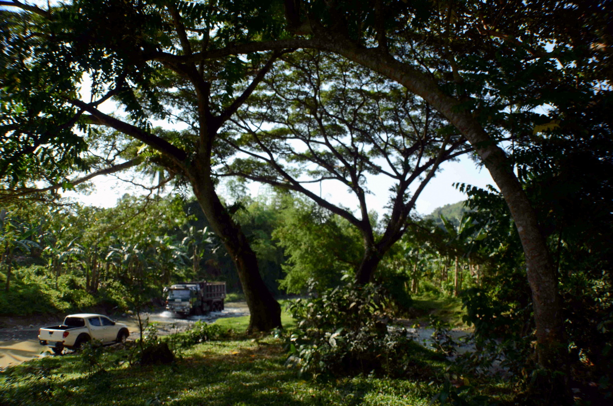
Located several kilometers from the sea, the water from the spring flows into the riverbed alongside. The spring’s water outflow is noted to be of considerable volume but was observed to have stopped during the month of October 2012. Huge earth moving trucks were observed passing on the river bed where they continue to an undetermined site to collect river gravel and sand for commercial purposes.
Noted in the pool of the spring are various fresh water species of mollusks, chordates and arthropods. The last exploration in the area confirms the presence of a large freshwater eel with an approx. length of 0.75-1 meter (locally known as ”Casili”). The observation formed the assumption that the area’s ecosystem is capable of allowing such specie to survive and to possibly reproduce.
The following questions remain:
- From where is the source of the water that flows from the cave?
- What are the possible effects of the river sand extraction to the cave’s ecosystem and the spring’s continued existence?
- How far and how long is the underwater cave system?
- What other freshwater flora and fauna exist in the area?
- What threats are affecting the endemic species?
- Has the farming community in the area made any impact to the water quality of the spring?
- How is the existing large-scale shipbuilding industry that is flourishing in the neighboring area of Barangay Buanoy impacting the water table in the immediate vicinity of Barangay Arpili and does it affect Casili Underwater Cave System?
 The FCD is hopeful that the Local Government Unit of Balamban Municipality will see the value of this priceless resource within their community and create the appropriate steps to protect the area to include the following points:
- An ordinance declaring CUCS as a Protected Area
- Pre-intervention documentation of flora and fauna endemic to the area
- Post-intervention documentation of flora and fauna endemic to the area
- Preservation and documentation of species, fossils and other paleontological and geologically important features in the area
- Monitoring and maintenance of the quality of the water in specific sections of the cave as per hydrological parameters
- Establishment of a management body and an enforcement plan adopted and enforced
- Zoning and regulation of specific activities passed by the management board/LGU
Article by:


Has this been discussed with the local government? If so, what are their plans to protect this underwater cave? Giving them a presentation of what you have discovered and try to set their sights on a certain objective would give them insights on what to do. This is a no-brainer for them if they see what you have seen. Unless of course they own those trucks getting sand and gravel. Business is more fun you know than cave diving.
Thanks for your comment. Yes, our concerns were reiterated to the Mayor, the Barangay Council and to the MENRO officers from the progress report we gave them after our rapid assessment of the area last January. We are hopeful that they are already taking the necessary steps to mitigate further damage to the site and its surrounding area.
Grateful for sharing thiss